Skip to content
walkwalk.
IJburg: the archipelago built from scratch
architecturewaterfront

IJburg: the archipelago built from scratch

Over 'the bra' bridge, through a grid on stilts, past the floating houses to a reclaimed wild.

Photo: S Sepp / Wikimedia Commons, CC BY-SA 3.0

Distance

4 km

Time

~ 90 min

Difficulty

Moderate

End

IJburg (tram 26)

Best at

afternoon

Right now
21°C· Overcast

Open in Maps for turn-by-turn, or take it offline as GPX.

IJburg is a set of islands Amsterdam poured into the IJmeer because it ran out of land, and walking it is the closest you'll come to watching a city decide to exist. Four kilometres across made ground, best in the afternoon, when the light off the water is the only thing here older than the buildings.

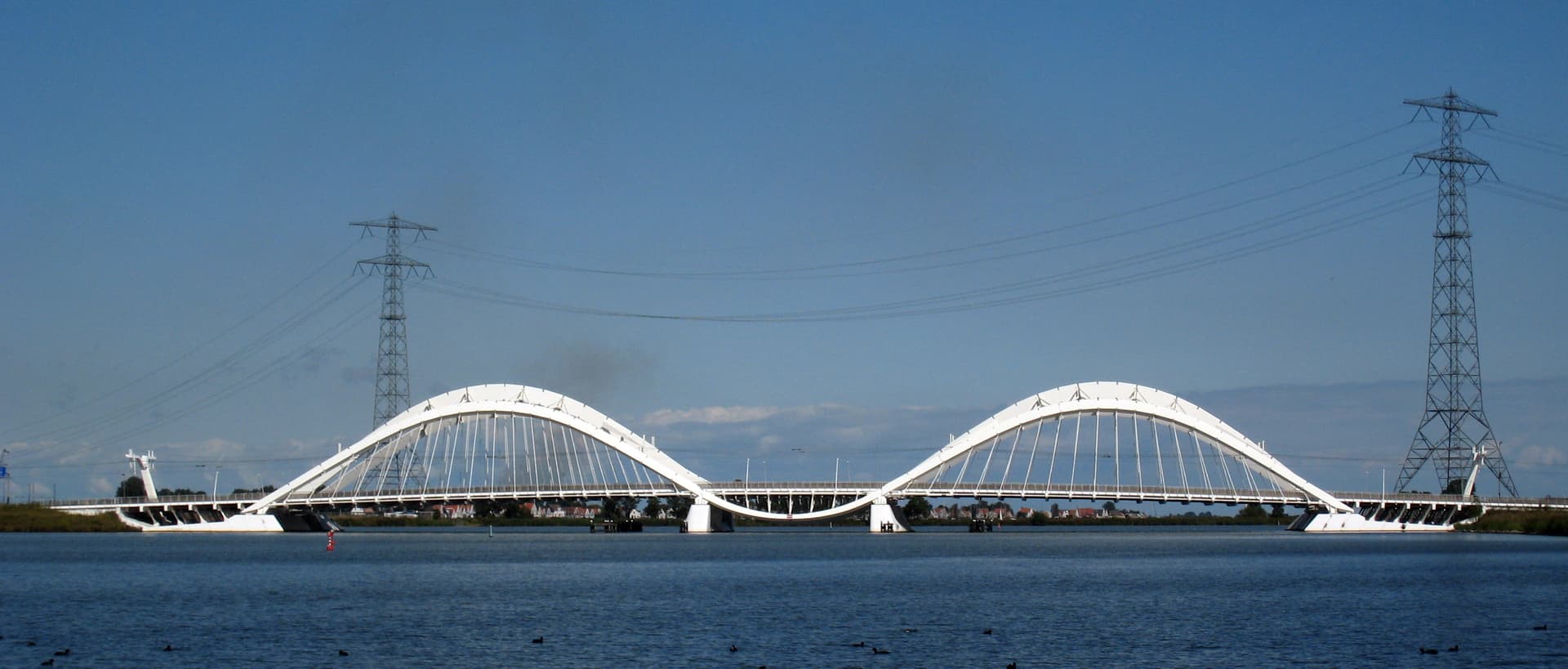
Take tram 26 out and get off to cross the Enneüs Heermabrug on foot — two steel arches the city calls 'the bra', and you'll see why. On Haveneiland, the main island, walk the grid toward the water; every plot was let to a different architect, so the street changes house by house. Down to the Bert Haanstrakade and its marina cafés, then over to Steigereiland and the Waterbuurt, Marlies Rohmer's houses floating on concrete hulls in a calmed pool. Walk the jetties like a street; people live on them.

End in the Diemerpark, and be honest about what it is: a capped landfill, sealed and remediated, opened as a park in 2004 and since gone gloriously wild. Ninety hectares of rough green over a buried past. Tram 26 takes you home from the IJburglaan.
The route

On the map.

Elevation

48 m·49 m·-15 m ASL

Stops along the way

Things to notice.

  1. 01
    1

    Enneüs Heermabrug

    The bridge onto the islands, with two steel arches the locals call 'the bra' — and once you've heard it you can't unsee it. Walk across rather than tram over it; the IJmeer opens out on both sides.

  2. 02
    2

    Haveneiland grid

    The main island, laid out as a strict grid of blocks barely twenty years old. Pick any cross street toward the water; the architecture changes house by house, every plot let to a different hand.

  3. 03
    3

    Bert Haanstrakade

    The harbour-front quay where IJburg faces its own marina. The cafés here look out over moored boats; this is the island at its most pleased with itself.

  4. 04
    4

    Waterbuurt, Steigereiland

    Marlies Rohmer's floating houses, sitting on concrete hulls in a sheltered pool off the IJmeer. Walk the jetties between them; people live here, so walk it like a street, not a viewing gallery.

  5. 05
    5

    Diemerpark

    A capped former landfill — household and chemical waste through the 1960s and 70s, sealed and remediated by 2001, opened as a park in 2004. Nature took the rest; it's now ninety hectares of rough green over a buried past.

  6. 06
    6

    IJburglaan tram stop

    Land back on the spine where tram 26 runs the length of the islands to Centraal. Time it for late afternoon and the light comes off the water all the way home.

Good to know

Before you go.

How long is the IJburg: the archipelago built from scratch walk?
About 4 km — roughly 90 minutes at an unhurried pace, plus however long you linger.
Where does it start and end?
It starts at IJburg (tram 26) and ends at IJburg (tram 26).
Is it free?
Yes. It's a self-guided route — free to follow, with no guide to book and nothing to pay.
When is it best?
It's best in the afternoon.