Skip to content
walkwalk.
Williamsburg: Bedford Avenue and the waterfront
waterfrontfood-forward

Williamsburg: Bedford Avenue and the waterfront

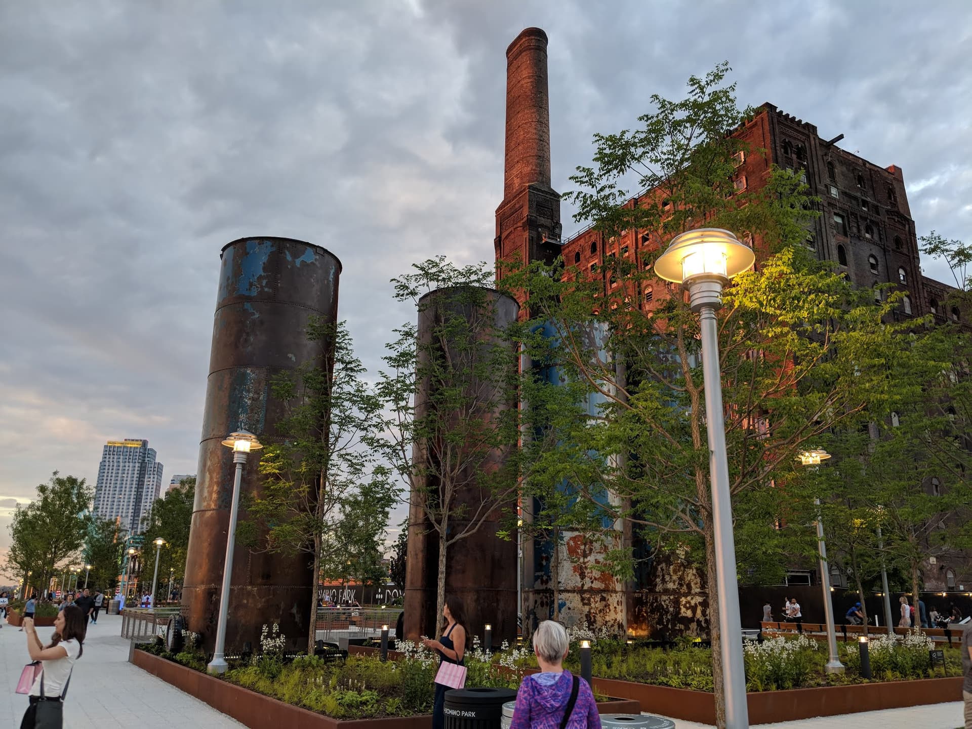
Bedford Avenue, the converted warehouses, and a park built around a sugar-refinery relic.

Photo: MusikAnimal / Wikimedia Commons, CC BY-SA 4.0

Drafted by Claude — the editor hasn’t walked this one yet. We’ll update this notice once it’s been verified on the ground.

Distance

3.5 km

Time

~ 85 min

Difficulty

Moderate

End

Marcy Av (J/M/Z)

Best at

afternoon

Right now
28°C· Overcast

Open in Maps for turn-by-turn, or take it offline as GPX.

Williamsburg is the neighbourhood that changed the most and wears it openly: the factories are shops now, the waterfront is a park, and the river that used to carry sugar carries commuters. Three and a half kilometres from the L train down to the water and along it.

Start on Bedford Avenue, the spine — the shops and cafés and record stores that the name is shorthand for. Then cut west, where the brick turns industrial and the old warehouses have become galleries and music rooms. Keep going to the river and Domino Park, built in the shadow of the Havemeyer sugar refinery, its brick hulk left standing on purpose. Walk the gantry path with the skyline straight across the water.

The NYC Ferry pier is here if you want the East River properly. And on a Saturday, Smorgasburg fills the lawn just north — dozens of food stalls and the river behind them, though only on the weekend, so time it.

End inland at Marcy Avenue, up on the elevated tracks under the bridge approach. The J runs over the rooftops here, which is the right way to leave.

The route

On the map.

Elevation

84 m·81 m·216 m ASL

Stops along the way

Things to notice.

  1. 01
    1

    Bedford Avenue

    Come up from the L and you're on the main spine — the shops, the cafés, the record stores. Walk it north to south at whatever pace the windows allow; this is the street the neighbourhood is shorthand for.

  2. 02
    2

    North 6th and the converted warehouses

    Cut west towards the river and the brick changes — old industrial blocks turned into shops, galleries and music rooms. The bones are still factory; the use is entirely new.

  3. 03
    3

    Domino Park

    A waterfront park laid out in the shadow of the old Domino sugar refinery, the Havemeyer brick hulk left standing as the landmark. Walk the elevated gantry path; the skyline sits straight across the East River.

  4. 04
    4

    North Williamsburg Ferry pier

    The NYC Ferry pulls in here at the foot of the park. You don't have to board, but the East River route is the best-value water transit in the city if you do.

  5. 05
    5

    Smorgasburg, East River State Park

    On a Saturday the open-air food market fills the lawn at Marsha P. Johnson State Park — dozens of stalls, the river behind them. Any other day it's just a fine patch of grass with a view; come hungry only on the weekend.

  6. 06
    6

    Marcy Av station

    Walk back inland under the approach to the Williamsburg Bridge, where the J/M/Z run on the elevated tracks. Climb up to the platform; the trains here run over the rooftops, not under them.