Skip to content
walkwalk.
Western Islands: the shipyard archipelago
villageywaterfront

Western Islands: the shipyard archipelago

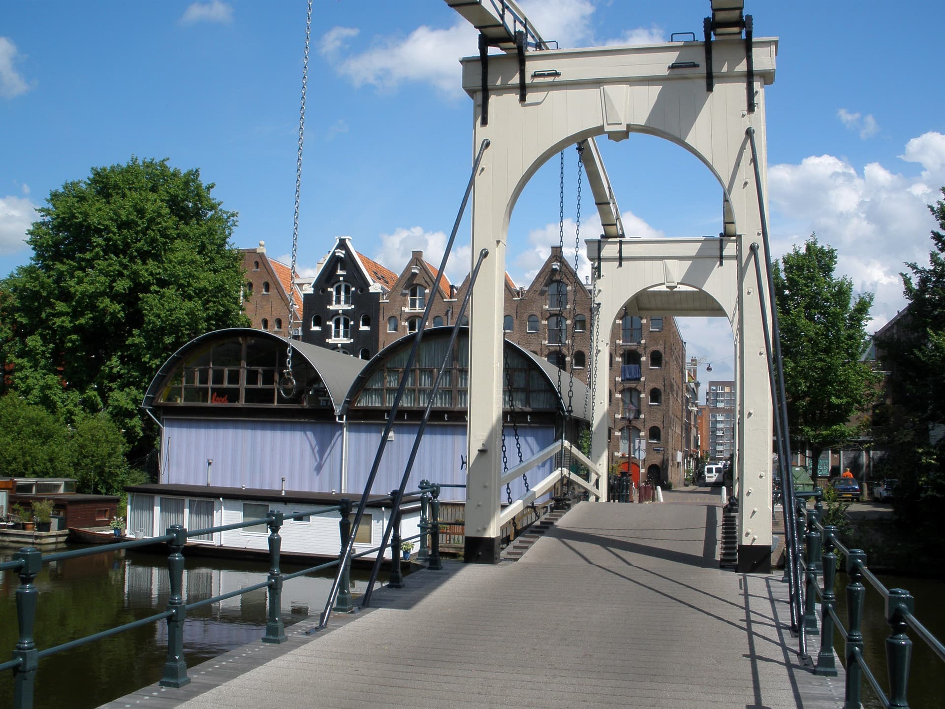
Working boatyards, a white wooden drawbridge, and the sand-market houses on the Zandhoek.

Photo: Jvhertum / Wikimedia Commons, Public domain

Distance

3.5 km

Time

~ 80 min

Difficulty

Easy

End

Amsterdam Centraal

Best at

morning

Right now
19°C· Clear

Open in Maps for turn-by-turn, or take it offline as GPX.

The Western Islands are three rectangles of made land, dredged up in the 1620s when the harbour ran out of room, and they still feel like a working edge of the city rather than a museum of one. Three and a half kilometres looped from Centraal through boatyards, over a wooden drawbridge, and along the prettiest quay most visitors never reach.

Walk in past the station and cross to Bickerseiland, where the Bickersgracht still has hauled-out boats and a serious houseboat row. The Drieharingenbrug — a white wooden drawbridge rebuilt to its 1625 lines, the narrowest in Amsterdam — takes you onto Prinseneiland, all converted brick warehouses and kept hoist beams. Galgenstraat, 'gallows street', earns one dry line: it looked across the water to where the city hanged people. It is, now, completely charming.

Cross to Realeneiland and the Zandhoek, a row of 17th-century sand-market houses with carved gable stones, and stop at De Gouden Reael on the corner for a drink at the water. Loop back to Centraal with the Westerdok opening up beside you.
The route

On the map.

Elevation

7 m·7 m·38 m ASL

Stops along the way

Things to notice.

  1. 01
    1

    Bickerseiland

    The first of the three man-made islands, dug in the 1620s for shipping and still half-industrial. Walk the *Bickersgracht*: working boatyards, hauled-out hulls, a houseboat row that means it. The city's noise drops away here.

  2. 02
    2

    Drieharingenbrug

    A white double wooden drawbridge for foot traffic only, rebuilt in 1983 to the 1625 design — the narrowest in the city, two abreast at most. Cross it slowly onto *Prinseneiland*; the crossing is the point.

  3. 03
    3

    Prinseneiland

    The middle island and the quiet heart of the walk: brick *pakhuizen* — old warehouses — converted to studios and homes, their hoist beams kept. Wander the lanes; there's no wrong turn on an island this size.

  4. 04
    4

    Galgenstraat

    'Gallows Street', named for the grim view it once had across the IJ to the Volewijk, where the executed were strung up for the city to see. One dry line of history; then walk on. The street is lovely now, which is the joke.

  5. 05
    5

    Zandhoek

    On *Realeneiland*, a short quay of 17th-century houses named for the sand market once held here, each with its own gable stone. The prettiest single row in the islands — read the carved stones as you pass.

  6. 06
    6

    De Gouden Reael

    The corner café-restaurant on the Zandhoek, named for the gold coin carved on its old gable. Stop for a drink at the water before you loop back toward Centraal; the view down the Westerdok is the reward.

Good to know

Before you go.

How long is the Western Islands: the shipyard archipelago walk?
About 3.5 km — roughly 80 minutes at an unhurried pace, plus however long you linger.
Where does it start and end?
It starts at Amsterdam Centraal and ends at Amsterdam Centraal.
Is it free?
Yes. It's a self-guided route — free to follow, with no guide to book and nothing to pay.
When is it best?
It's best in the morning.