walkwalk.
Nyhavn and Amalienborg: the postcard and the working palace
waterfrontheritage

Nyhavn and Amalienborg: the postcard and the working palace

Nyhavn's painted townhouses, the changing of the guard, and the dome at the end of the axis.

Drafted by Claude — the editor hasn’t walked this one yet. We’ll update this notice once it’s been verified on the ground.

Distance

2.5 km

Time

~ 75 min

Start

Kongens Nytorv metro (M1/M2/M3/M4)

End

Kongens Nytorv metro (M1/M2/M3/M4)

Best at

morning

Right now
23°C· Partly cloudy

Open in Maps for turn-by-turn, or take it offline as GPX.

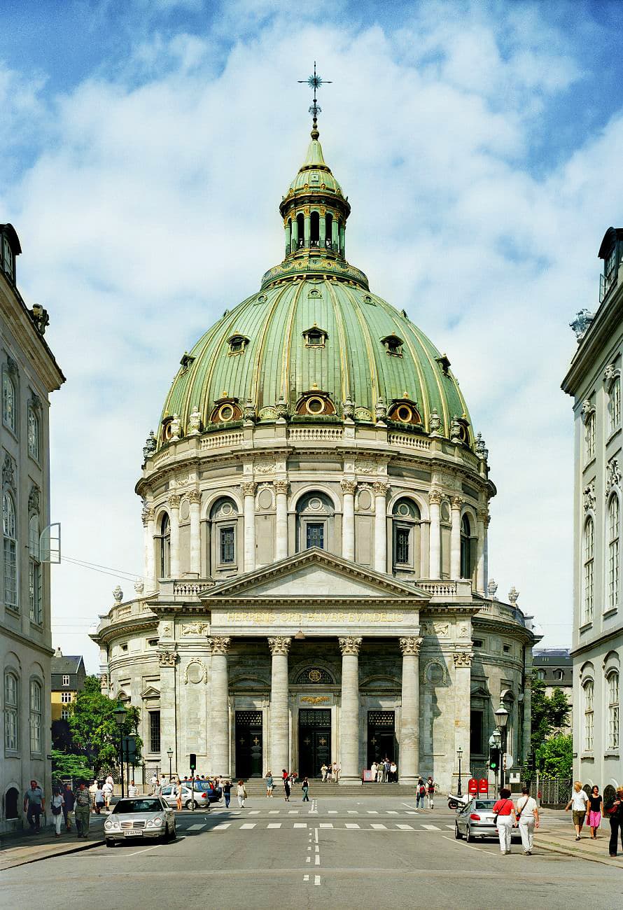
Nyhavn is the harbour postcard — the seventeenth-century canal lined with painted townhouses you've seen in every Copenhagen photograph. Amalienborg is the working royal palace, four identical Rococo houses around an octagonal courtyard, the guards changing at noon, the dome of the Marmorkirken (Marble Church) closing the axis a few streets behind.

Two and a half kilometres, seventy-five minutes if you time the guard right. Start at Kongens Nytorv and walk north into Nyhavn — the sunny northern side is the postcard, the southern side is where Hans Christian Andersen actually lived. Walk to the bridge at the far end, then loop back south and cut east into Amaliegade.

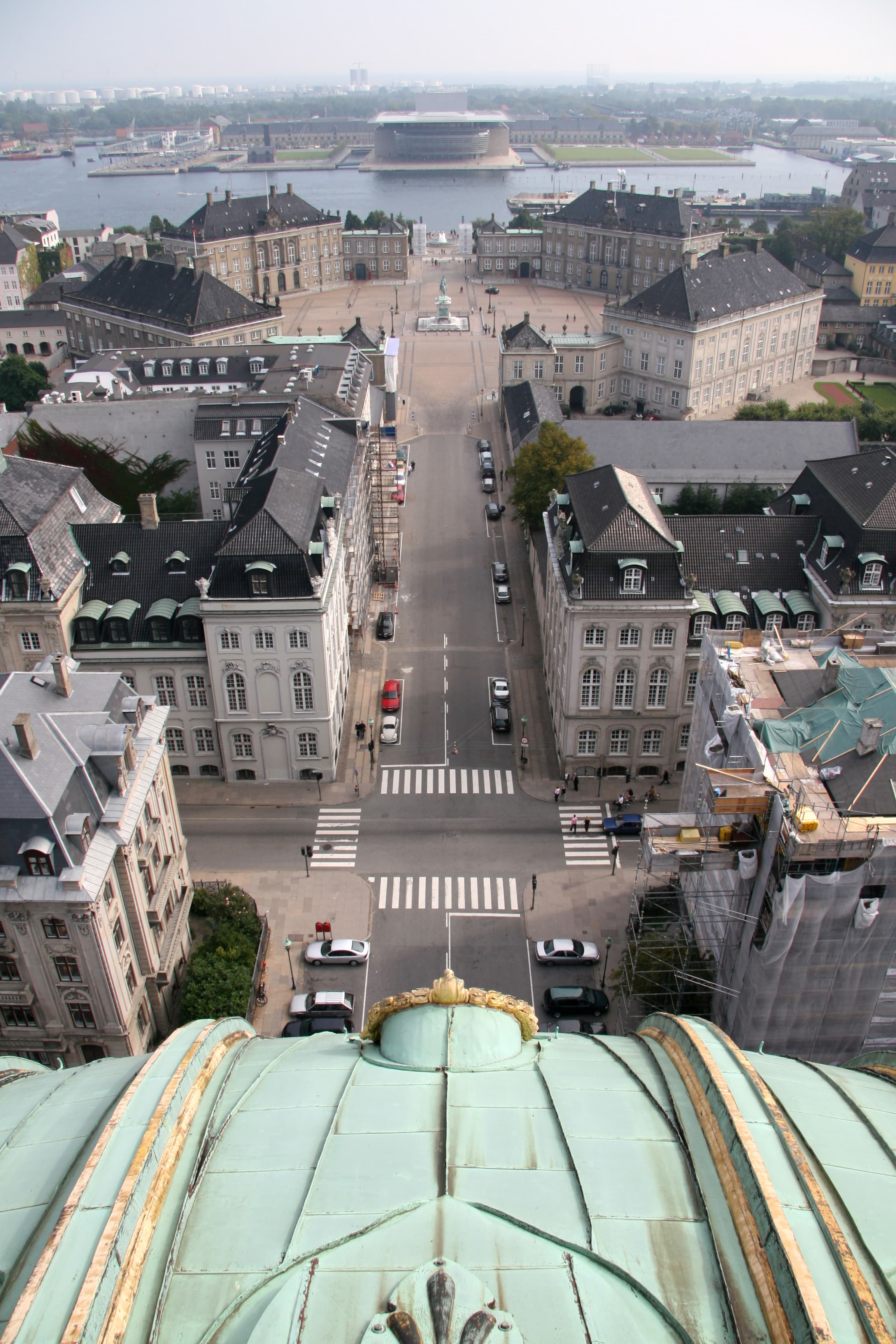
The royal palaces face their octagonal Slotsplads. The watch changes at twelve; ten minutes early gives you the railing view. The Marble Church dome closes the axis behind the palaces — Frederik V's 1749 ambition, finished in 1894 after a hundred and forty-five years of funding crises. Loop back to Kongens Nytorv down Bredgade, the street of eighteenth-c noble palaces. King Frederik X has lived in Frederik VIII's Palace since 2010; the family is occasionally home.

The route

On the map.

Stops along the way

Things to notice.

  1. 01
    1

    Kongens Nytorv

    The metro at the eastern end of *Strøget*; M1/M2/M3/M4 all stop here. *Nyhavn* opens immediately to the north — you'll see the masts before you see the water.

  2. 02
    2

    Nyhavn

    The seventeenth-century canal Christian V dug between 1670 and 1673, using Swedish prisoners of war. The painted northern townhouses are the postcard; Hans Christian Andersen lived on the southern side at numbers 20, 67 and 18 across his life. Walk end-to-end; restaurants get pricey, the walk is free.

  3. 03
    3

    Amalienborg Slotsplads

    The octagonal courtyard between the four identical Rococo palaces Nicolai Eigtved built mid-18th c. for noble families, taken over by the royal family in 1794 after *Christiansborg* burned. *Den Kongelige Livgarde* — the Royal Life Guards — change at noon. Arrive by 11:50 for a clear view from the railing.

  4. 04
    4

    Frederik's Church (Marmorkirken)

    The Marble Church. Frederik V laid the cornerstone in 1749; funding collapsed and the dome wasn't finished until 1894. The largest church dome in Scandinavia. Free to enter outside services; the rotunda is the spectacle, the marble itself is mostly limestone in the lower courses.

  5. 05
    5

    Bredgade

    The wide street parallel to *Amaliegade*, eighteenth-c noble palaces all the way down — many now embassies or institutional offices (the Russian Embassy compound, the Medical Society building, the *Designmuseum Danmark* in the old Frederiks Hospital). Walk slowly; the buildings are the destinations.

  6. 06
    6

    Back to Kongens Nytorv

    *Bredgade* lands you back at the square. Cityringen metro for the next walk, or sit at one of the cafés for lunch — *Café à Porta* on the south side has been doing the same since the 1790s.