walkwalk.
Christianshavn: the canal district and the spiral spire
canalheritage

Christianshavn: the canal district and the spiral spire

Christian IV's seventeenth-century Dutch-style canal town, with a golden spire you can climb.

Drafted by Claude — the editor hasn’t walked this one yet. We’ll update this notice once it’s been verified on the ground.

Distance

3 km

Time

~ 90 min

Start

Christianshavn metro (M1/M2)

End

Christianshavn metro (M1/M2)

Best at

afternoon

Right now
15°C· Partly cloudy

Open in Maps for turn-by-turn, or take it offline as GPX.

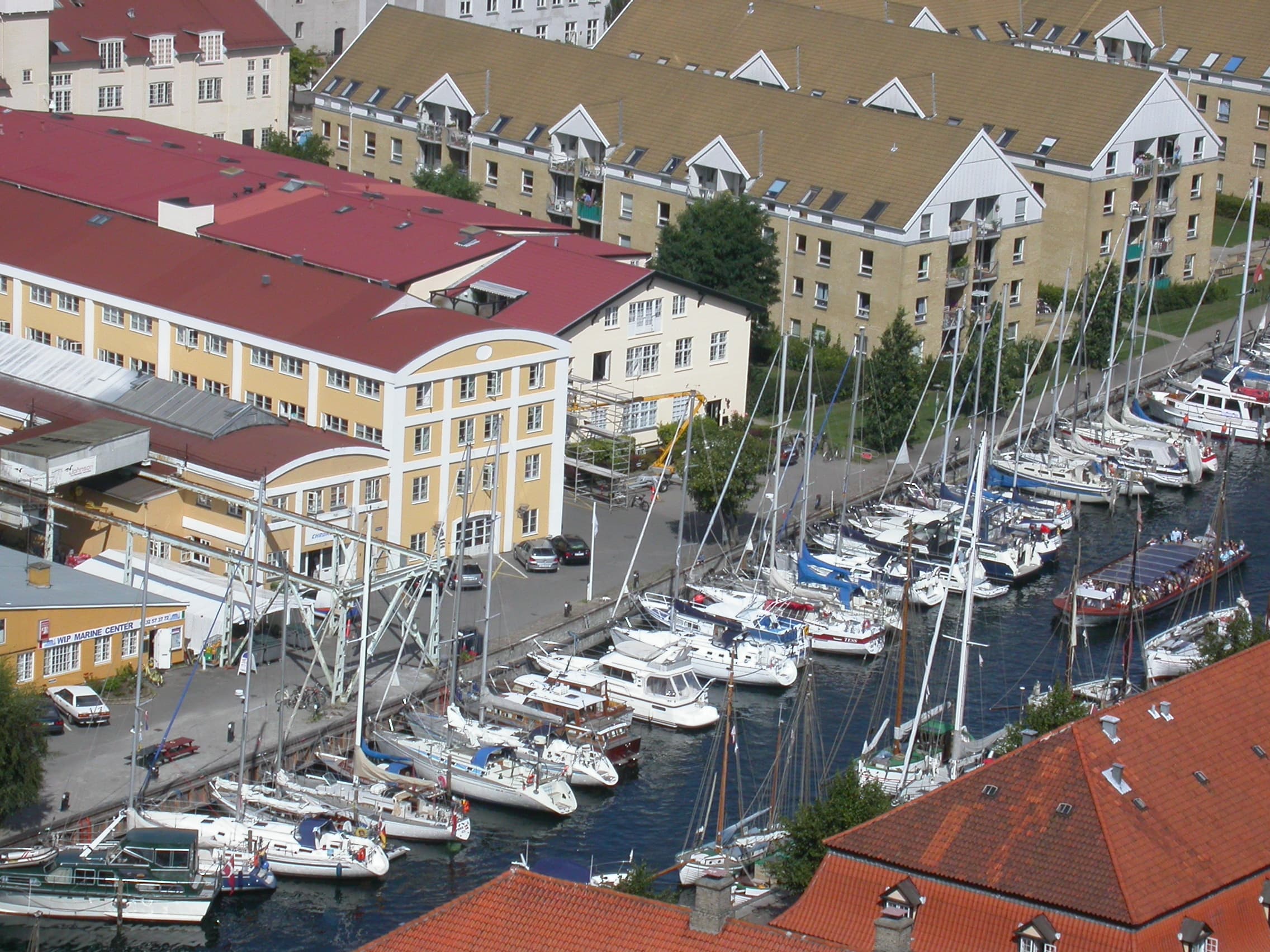
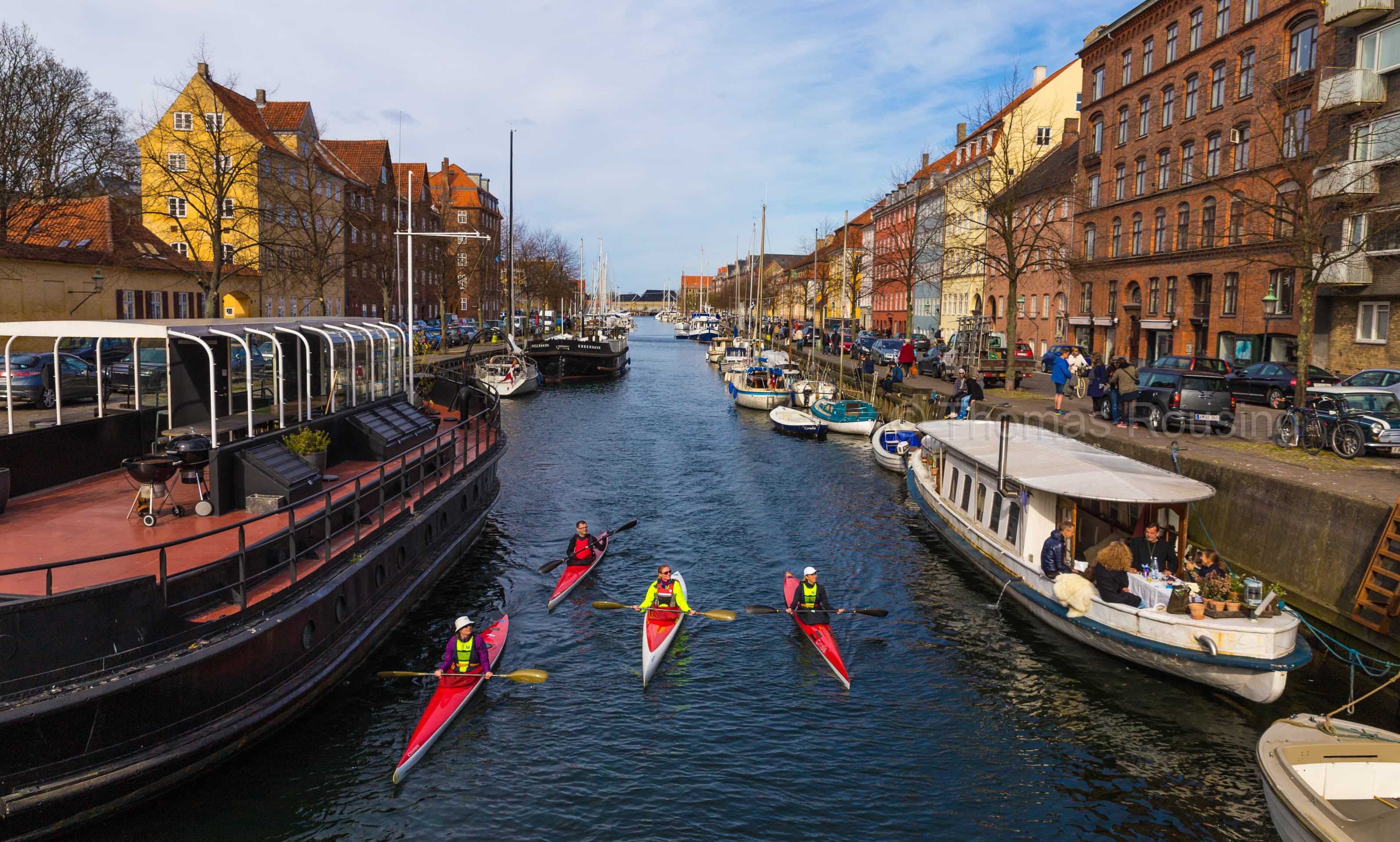
Christianshavn is the Dutch-style canal town Christian IV laid out in 1617 on the eastern side of the inner harbour, fortified to defend the city. The merchant houses on Strandgade are the seventeenth century; the houseboats on Wilders Kanal are the present; the golden spiral spire on Vor Frelsers Kirke is the photograph everyone takes.

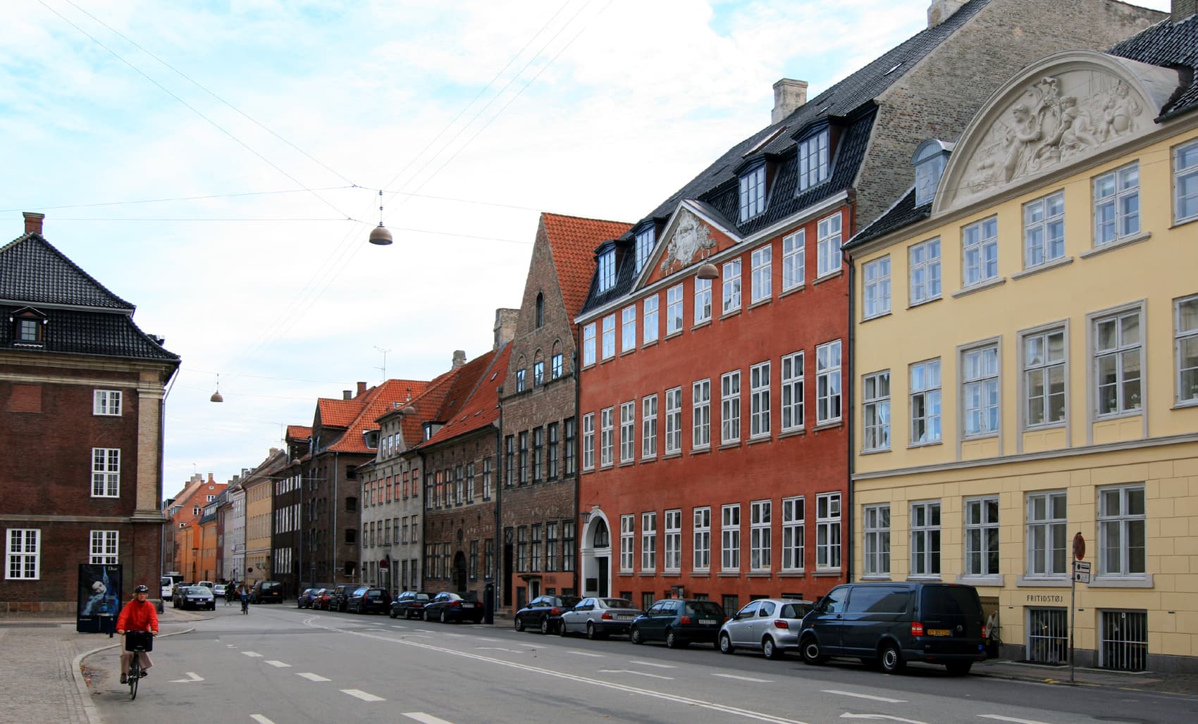
Three kilometres, ninety minutes, with the climb. Christianshavn metro (M1/M2) lands you at the centre. Christianshavns Torv is the village square — bicycle traffic, cafés, the daily rhythm of a working neighbourhood. South across Wilders Kanal to Strandgade, where the 17th-c merchant houses still face the inner harbour.

The church is the spire. Vor Frelsers Kirke is 1696; the famous golden spiral was added in 1752 — Lauritz de Thurah's outdoor staircase climbing counter-clockwise to the top, four hundred steps and the best view of the harbour available without a helicopter. Check before you go; restoration closes it intermittently.

End at Wilders Plads — a small square on the canal, cafés in old warehouses, houseboats moored along the quay. Five minutes back to the metro.

The route

On the map.

Stops along the way

Things to notice.

  1. 01
    1

    Christianshavn metro

    M1/M2 stop at the centre of the canal district. Step off and you're at *Christianshavns Torv*; the canals begin within minutes in any direction.

  2. 02
    2

    Christianshavns Torv

    The village square. Bicycle traffic, cafés, a small market some weekdays. The bridges either side cross to the rest of *Christianshavn* — west to *Strandgade*, east to *Wilders Kanal*, south to *Vor Frelsers Kirke*.

  3. 03
    3

    Wilders Kanal + the houseboats

    The smaller canal on the east side. Houseboats moored along the quay — some private homes, some short-term rentals, all with shifted-paint character. The waterside cafés on the canal's north side keep the same character year-round.

  4. 04
    4

    Strandgade

    The main street, running along the inner-harbour side. Seventeenth-century merchant houses — *Asiatisk Plads* (the old Asiatic Company complex) at the southern end, *Eigtveds Pakhus* halfway up, the Foreign Ministry compound in between. Look up; the gable details are the show.

  5. 05
    5

    Vor Frelsers Kirke (Church of Our Savior)

    The church is 1696, baroque, modest from outside until you see the spire. Lauritz de Thurah's 1752 golden spiral climbs counter-clockwise to the top — four hundred steps, an outdoor staircase, the best view of the harbour available without a helicopter. Restoration has closed the spire intermittently in recent years; check before going.

  6. 06
    6

    Wilders Plads

    A small square on the canal, cafés in old warehouse buildings, houseboats moored opposite. The 19th-c shipyard cranes on the *Refshaleøen* side are visible across the water. Five minutes back to the metro.